With my broken Treo, I felt like I was getting my weather briefing for the trip home with one arm tied behind my back. The briefer initially gave me a glowing report for the trip home, saying that there was a cold front, but it wasn’t anywhere near my route of flight. But then he started reading the NOTAMs for Rochester and told me that runway 16 was closed. Rochester doesn’t *have* a runway 16. Wait a second – “I did say Rochester NY, didn’t I?” Ok, time to start over. Suddenly the cold front was very significant. The weather now was similar to the trip out – VFR between Pinckneyville and Lima Allen County, but an airmet for turbulence below 6,000 feet for much of the route. It was going to be breezy for both landings. There was also going to be ice in the clouds from Cleveland on, and the freezing level was going to be lower than on Friday – as low as 3,000 feet between Buffalo and Rochester. Oh, and some convective activity around Buffalo.
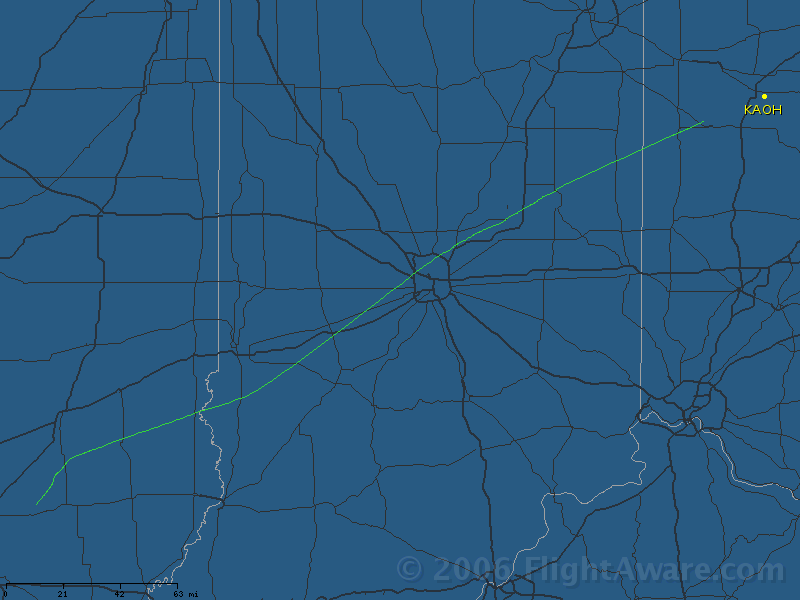
I was pretty sure I could handle it, and finding a place to land en-route and waiting it out would always be an option. So I filed the first leg IFR from the BIB VOR on to AOH, figuring that it would be easier to pick up the clearance in the air than in a tiny uncontrolled field, especially without a cell phone.
As I lifted off from the runway, a voice came over the radio warning me about the presence of motorcycles and to conduct myself accordingly. And with that, I bid a fond farewell to PJY. It was a bit bumpy on the way up, but was smooth at altitude. It was a great clear day, and not much haze. I had a bit of trouble remembering how to pick up an IFR clearance in the air – I initially contacted Flight Service, but they put me straight and gave me a Kansas City Center frequency to call.
The only other excitement was due to my having gobbled down a couple of hard boiled egg just before I took off – suffice it to say I can’t apologize to Mark enough for the result of that. Once again we saw the airport from well away, and cancelled IFR, and entered the downwind. It was bumpy down low and pretty gusty winds, but I think I did one of my better landings of the weekend, if I do say so myself.
In the FBO, we borrowed the courtesy car, and went into town to grab a bite to eat. Mark put some gas in the car, so they waived the $10 rental fee. There was some sort of 4WD festival going on, and we saw a lot of people from that. We also checked the weather, and it looked pretty crappy. The winds were getting worse, the icing pilot reports were getting more numerous, and there were several areas of yellow and red on the radar around Buffalo. Once again, the plan was to try it, and be flexible.
 As we’d been cut loose from Indiana Approach coming into AOH, we’d been told to contact them on the same frequency to pick up our next clearance, and so we did. In spite of the fact that I filed the same route (in reverse) that I’d had on the way down, which had netted me a re-route along the way, I got “cleared as filed”.
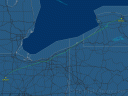
Somewhere between Indianapolis and Cleveland, the clouds started filling in below us, and I had to ask for higher to stay in the clear. I could see solid clouds below for as far as the eye could see, but more importantly I couldn’t see any clouds boiling up into the stratosphere. I was up to 9,000 feet or so over Cleveland, and they gave me a short vector to get me off Victor 14 over the airport, which you can see in the flight track.
Between Dunkirk and Buffalo, when they turned me over to Buffalo approach, the clouds were suddenly higher and I knew I’d soon be in them. I asked what they could see on the radar and they suggested that I go direct to Rochester which would put me between two areas of rain. I didn’t have anything on the Stormscope, so I wasn’t worried about thunderstorms any more. But not long after I was in the clouds and picking up ice. I asked for lower, and they soon sent me to 6,000, and then 4,000 as that *still* didn’t put me out of the clouds. A few times I got between layers and it looked like ice was coming off, but then the layers shifted and I was back in it. I asked for still lower, because I could see the bases not too far down. He said he couldn’t vector me down lower there, but he’d send me north to where the MVA (Minimum Vectoring Altitude) was 3,000 feet. On the vector, I got clear of the clouds and could see Batavia down below me. When he’d got me where he wanted and down to 3,000, I was definitely below the freezing level and the ice came off very fast. Which is good, because if that hadn’t worked I probably would have made a precautionary landing at Batavia, or cancelled IFR and scud run at 1,500 feet.
The Rochester controller didn’t seem to believe me that I was landing a small GA plane in this weather. He gave me numerous un-requested wind checks. It was varying between 30 and 40 knots, and I swear at least once it was gusting up to 48 knots, but fortunately it was only 10 or 20 degrees off of the nice long and wide Runway 28. I had to cinch up my seat belt to keep from hitting my head. It wasn’t a pretty landing, but with the strong winds I could keep a lot of power in, which helped. Taxiing back to the tie down I had to pause and think about how you are supposed to hold the controls while taxiing, because I rarely bother with such a heavy aircraft in normal light winds.
It was a challenging flight, a learning experience, and a great way to end a great weekend.

 This is about that stage. (As you can see, I’m a firm believer that a clean organized desk is obviously a pre-requisite for doing good work.)
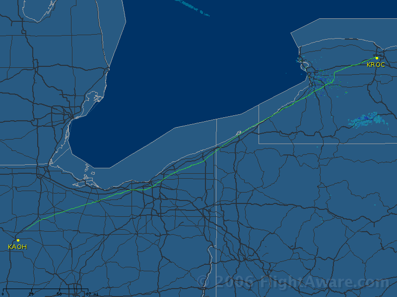