As reported in Rants and Revelations : The Computer Doctor is IN, I did some major disk swappery when Stevie’s iBook died a few months ago. I put Stevie’s hard drive in Vicki’s iBook, and Vicki’s hard drive in a 15″ Powerbook Titanium that she borrowed from work. Well, Stevie graduated, and as a graduation present she was given a MacBook. So it’s time to reverse the surgery, putting Vicki’s hard drive back in her iBook, and the original hard drive back in the Powerbook.
Time to haul out the Torx and Phillips screw drivers, and most importantly the Fixit Guilde.
Putting the hard drive back in the Powerbook is pretty straight forward, except taking the ide cable off the hard drive is a little brute force for my liking. Only 9 screws, all the same head and general size. And after a little coaxing and swearing, it went back together and booted.
Putting the hard drive back in the iBook is a real pain in the ass. Lots of fiddly crap, including a bit where it says
Breathe deeply. Trying times are ahead, but we promise the lower case does come off.
and another bit where after about 30-45 minutes of work, you get to the bit where it says
Remove the following 16 screws:
But at least they put handy little loops on the ide cables so that they could be removed without bending any pins.
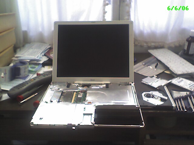
 This is about that stage. (As you can see, I’m a firm believer that a clean organized desk is obviously a pre-requisite for doing good work.)
Actually, it was a lot easier having done this a few times now. But I still held my breath as I booted it up and make sure the fiddliest bits, the trackpad and speaker cables got hooked up correctly and it boots properly. And it did! Yay for me!
While dis-assembling and assembling this iBook, several of the Torx screws were getting very rounded off – I had a hell of a time removing one or two of them. I have my doubts that I’ll be able to get the screws off again. I guess next time it breaks, Vicki will have to get a MacBook too.